


CUBA 65 Voting District, Lake County, Illinois
About
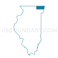
Outline

Summary
| Unique Area Identifier | 572398 |
| Name | CUBA 65 Voting District |
| County | Lake County |
| State | Illinois |
| Area (square miles) | 2.35 |
| Land Area (square miles) | 2.10 |
| Water Area (square miles) | 0.26 |
| % of Land Area | 89.13 |
| % of Water Area | 10.87 |
| Latitude of the Internal Point | 42.22854360 |
| Longtitude of the Internal Point | -88.17326840 |
Maps


Graphs
Select a template below for downloading or customizing gragh for CUBA 65 Voting District, Lake County, Illinois


Neighbors
Neighoring Voting District (by Name) Neighboring Voting District on the Map
- Algonquin 49 Voting District, McHenry County, IL
- CUBA 66 Voting District, Lake County, IL
- CUBA 69 Voting District, Lake County, IL
- CUBA 70 Voting District, Lake County, IL
- CUBA 72 Voting District, Lake County, IL
- Nunda 7 Voting District, McHenry County, IL
- WAUCONDA 352 Voting District, Lake County, IL
- WAUCONDA 354 Voting District, Lake County, IL
Top 10 Neighboring County Subdivision (by Population) Neighboring County Subdivision on the Map
- Algonquin township, McHenry County, IL (88,389)
- Nunda township, McHenry County, IL (38,245)
- Wauconda township, Lake County, IL (21,730)
- Cuba township, Lake County, IL (16,826)
Top 10 Neighboring Place (by Population) Neighboring Place on the Map
- Lake Barrington village, IL (4,973)
- Port Barrington village, IL (1,517)
- Tower Lakes village, IL (1,283)
Top 10 Neighboring Elementary School District (by Population) Neighboring Elementary School District on the Map
Top 10 Neighboring Secondary School District (by Population) Neighboring Secondary School District on the Map
Top 10 Neighboring Unified School District (by Population) Neighboring Unified School District on the Map
- Barrington Community Unit School District 220, IL (44,132)
- Wauconda Community Unit School District 118, IL (27,202)
Top 10 Neighboring State Legislative District Lower Chamber (by Population) Neighboring State Legislative District Lower Chamber on the Map
Top 10 Neighboring State Legislative District Upper Chamber (by Population) Neighboring State Legislative District Upper Chamber on the Map
Top 10 Neighboring 111th Congressional District (by Population) Neighboring 111th Congressional District on the Map
Top 10 Neighboring Census Tract (by Population) Neighboring Census Tract on the Map
- Census Tract 8713.05, McHenry County, IL (6,705)
- Census Tract 8708.12, McHenry County, IL (4,873)
- Census Tract 8642.04, Lake County, IL (4,795)
- Census Tract 8643.03, Lake County, IL (4,522)
- Census Tract 8643.05, Lake County, IL (3,851)
- Census Tract 8643.06, Lake County, IL (2,269)